Aerial Images App: Mallorca’s Transformation from 1968 to Today at a Glance
Comparing Mallorca’s Old and Current Aerial Photos
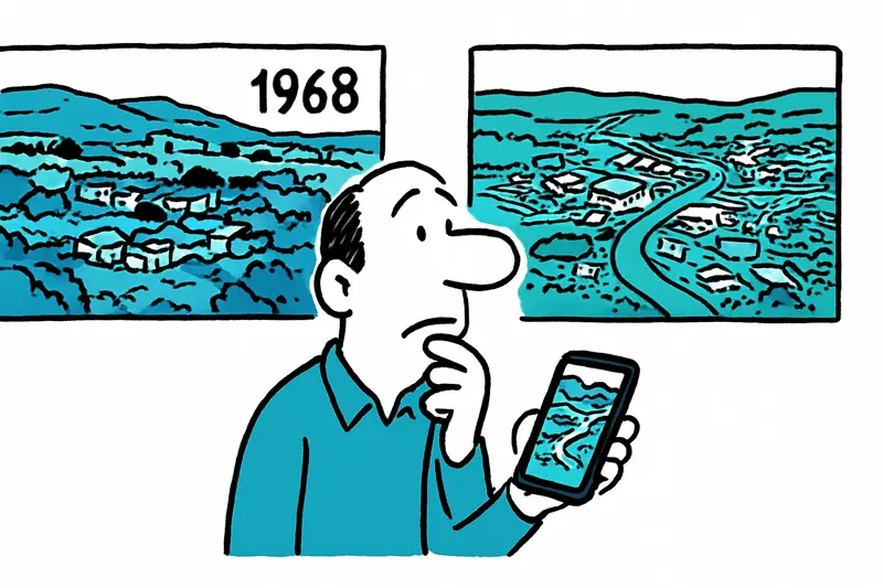
Compare Mallorca’s 1960s aerial photos with today’s images using the Consell’s free online map viewer.
Answer
How can I compare old and current aerial photos of Mallorca?
More questions on this topic
Related follow-up questions from the same article, collected in one place.
Is the Mallorca aerial map viewer free to use?
Yes, the viewer is free and open to everyone without registration.
What can I do with the Mallorca aerial images app besides viewing photos?
You can compare images, measure distances and areas, and export views as PDF.
When is the best time of year to use Mallorca’s map viewer for landscape comparisons?
You can use the viewer any time of year, whenever you want to compare old and new Mallorca images.
Can the Mallorca aerial photos help with planning or local research?
They are useful for first checks, research, and education, but not as a substitute for professional surveys.
What has changed in Palma’s coastline and suburbs over the years?
The images show coastal growth, road changes, and expanding built-up areas around Palma.
Can I find old aerial views of Alcúdia or Cala Millor in the Mallorca viewer?
Yes, the viewer includes historical images for places such as Alcúdia and Cala Millor.
How can schools use Mallorca’s historical aerial photos in class?
Schools can use the images for geography, planning, and environmental lessons.
Similar notes
Discover more interesting content

Boat Tour with BBQ along Es Trenc Beach

Private transfer from Mallorca Airport (PMI) to Pollensa
