How Mallorca Grew from Space: New Platform Shows Images from 1956 to 2024
How Mallorca Grew from Space: New Platform Shows Images from 1956 to 2024
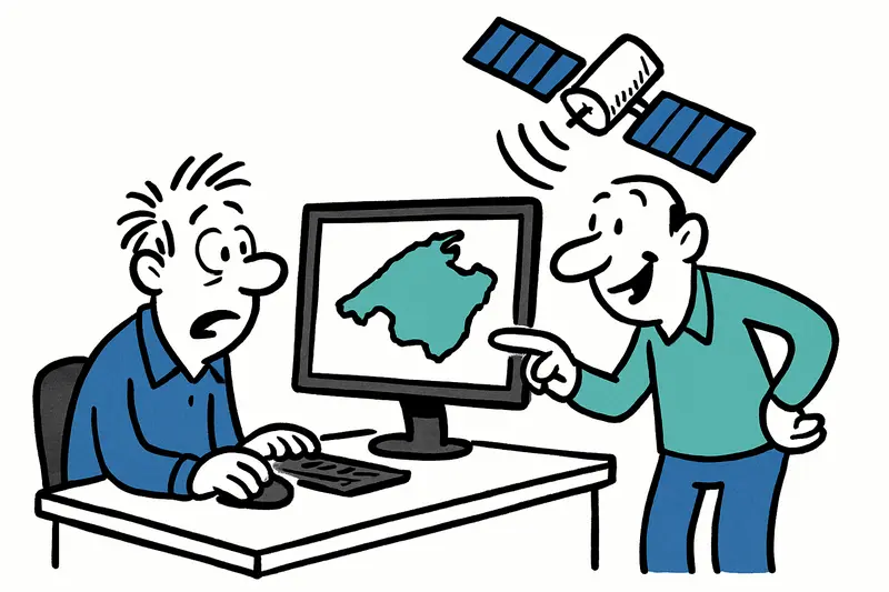
The Island Council presents an interactive map platform: historical aerial and satellite images of Mallorca from 1956 to 2024, a German-language interface component, and tools for comparing, measuring and documenting.
How Mallorca Grew from Space: New Platform Shows Images from 1956 to 2024
A digital tool for authorities, professionals — and the curious on the island
On Passeig Mallorca, where in the morning you hear the clatter of the street sweepers and the first coffee cups clink, you can try a nice experiment: look at the island with the eyes of the past. The Consell has released an online application that brings together aerial and satellite images of Mallorca from several decades — starting in 1956 up to current images from 2024. For people who live or work here, it's a handy kind of time travel.
The collection includes image years that were not always easy to access: 2004, 1973, 1968 and other years are now available via Mallorca's spatial data infrastructure (IDEmallorca). They are complemented by 1998 maps from the National Geographic Institute (PNOA) as well as images provided by the Balearic Government (IDEIB): 2024, 2023, 2021, 2018, 2015, 2012, 2010, 2008, 2006, 2002, 2001, 1995, 1989 and 1984.
The interface is deliberately user-friendly and offers functions usually used mainly by professionals: whoever draws lines, areas or points can measure precisely, perform area calculations or place their own markers. If someone needs a map as evidence, they can export the view as a PDF and easily include it in reports or applications.
A small technical treat is the slider for direct comparison of two years. It makes visible how settlements have expanded, where coastlines have changed or agricultural plots have lost their shape. For residents of coastal towns this is not an abstract game: changes to the beach, new promenades or reclaimed land become understandable with a simple swipe.
The platform also accepts local user data and allows searches by cadastral reference, municipality, industrial area or entry as a rural parcel. In practice this means: an architect in Cala Major, an environmental group in Sóller or a farmer in Inca can add their own information and make precise comparisons, reflecting trends described in Mallorca's new residential axis: Villages grow, Palma keeps moving.
The minister responsible for spatial planning and innovation highlighted the effort to bring together many series of historical images so that administrations and professionals can more easily produce studies, a topic also explored in When the Surroundings Overtake Palma: Opportunities, Risks and the Quiet Revolution on the Island. At the same time, the application is intended to be open to interested citizens — and the interface now offers predominantly German texts, which here on the island often makes everyday situations easier.
Why this is useful for Mallorca can be explained with concrete examples: municipalities can review development, conservation groups can observe coastal trends, schools can teach local history vividly with map materials and farmers can analyse the development of their plots, as argued in When Mallorca Grows: Strategies for an Island in Transition. I see this often: on Plaça del Mercat people sit with tablets, compare old and new images and point out where almond trees used to stand or where a road has appeared.
A small practical suggestion to get started: open the portal, choose two years, use the slider to reveal the differences, draw an area around your favourite beach and then save the view as a PDF. For young people in a community group this is a quick entry into research — without complicated software.
One outlook: such digital archives could lead to local workshops where citizens and communities start their own mapping projects. Think of neighbourhood initiatives that document changes or schools researching their own place over time. This is not a distant future — the technology is on the table now.
The application makes it clear: Mallorca is not just a postcard beach, but a space with a history that can be read on maps. The next time you walk along the harbour at Plaça de Toros you can imagine what the 1973 aerial photo looks like there — and how the island has taken shape since. A small tool, great fun for everyone who likes to see how the island became what it is today and what to work on tomorrow.
Frequently asked questions
How can I compare old and new aerial images of Mallorca?
What can the new Mallorca map platform be used for?
Can I use the Mallorca aerial image portal without being a professional?
What years are available in Mallorca’s historical image archive?
How can I check changes in my Mallorca neighbourhood or beach area?
Can I download a Mallorca map view as a PDF?
Is the Mallorca mapping tool useful for schools and local history projects?
Does the Mallorca aerial image platform have German language options?
Similar News

Ballermann in the Crosshairs: Police Stop Organized Pickpocket Gang
18 people arrested: An internationally organized group systematically exploited Playa de Palma, using distraction, viole...

Flight and Arrest Warrant in Mallorca: The Search for a Six-Year-Old Girl
The Guardia Civil is searching Mallorca for a 37-year-old German accused of taking his six-year-old daughter. The case s...

Orange Alert: Why the Heat This Time Runs Deeper Than the Thermometer
AEMET has issued an orange alert for parts of Mallorca. Key question: Are local measures sufficient to protect older peo...

120 apartments in Parc Bit: A drop in the ocean?
The Balearic government plans 120 temporary rental apartments in the Parc Bit technology park — for researchers and empl...

More National Police Officers in Summer: Are Additional Patrols Enough in Mallorca?
The Spanish Policía Nacional is increasing its presence in the Balearic Islands as part of 'Operación Verano 2026'. On M...
More to explore
Discover more interesting content

Boat Tour with BBQ along Es Trenc Beach

Private transfer from Mallorca Airport (PMI) to Pollensa
