
Cameras at Es Trenc: Help against parking chaos or a displacement mechanism?
Recently, cameras at the Sa Barralina car park have been counting spaces in real time. Can they really solve the Sunday chaos on the south coast — or do they create new problems for residents and nature?
Cameras at Es Trenc: Help against parking chaos or a displacement mechanism?
Anyone who drives toward Es Trenc on a hot Sunday knows the scene: slowing cars, long looks, a glimmer of hope behind every bush for a vacant spot. For several weeks inconspicuous cameras have been mounted at Sa Barralina, intended to report in real time how full the parking areas are, as noted in a report on cameras at Sa Barralina. The key question remains: do the cameras solve the problem — or simply move it elsewhere?
What was installed — and what does it feel like?
The technology is the same already used in Mondragó Natural Park at s’Amarador and ses Fonts de n’Alís. At Sa Barralina sensors count occupied parking spaces. In the morning the sun beats down, beach bars take first orders and two attendants in high-visibility vests guide vehicles. The cameras themselves remain inconspicuous; what stands out more are the new signs indicating "free parking spaces" and a small display at the entrance that a week ago still seemed broken — so much for reliability at the start, similar to other digital monitoring of Mallorca beaches and car parks. For background on the protected area where similar systems operate, see Mondragó Natural Park information.
The previously little-noticed questions
Central question: What happens when the display reports "full"? Then many drivers keep going — and may end up in the narrow streets of Ses Covetes or in residential areas where parking is actually forbidden. That is the often overlooked downside: technology can steer flows, but it also displaces them. Who protects the village centers from becoming overflow parking lots?
A second issue is data protection. Officially the systems only record occupancy data, not licence plates. Yet there is seldom public discussion about how long images are stored, who has access, and whether third parties may use the data; for legal context see the AEPD guidance on video surveillance. Transparency here is more than a roadside sign — it is an obligation to residents.
What the numbers alone do not say
Real-time data are a useful tool, but not a miracle cure. They show free spaces — not traffic peaks, narrow roads, or drivers' willingness to drive another ten minutes. Without accompanying measures there is a risk that everyone will rush to a single display in the morning, and around the next bend the next bottleneck awaits. Good traffic management needs several layers: signalling, diversions, staff on site and alternatives to the car.
Concrete opportunities — if they are used
The technology does offer opportunities: if data are open and provided in real time to navigation apps, drivers could be redirected in time. Combined with temporary shuttles from larger car parks, clear signage and functioning staff at junctions, the strain on villages can be reduced. The technology can also help detect illegal parking in dunes and protected areas and thus protect sensitive habitats — provided the data are actively used for conservation measures, for example in dune habitat protection.
Concrete proposals
A few simple ideas that would help immediately:
1. Create transparency: Disclose what data are collected, how long they are stored and who uses them.
2. Networking: Signs on the motorway and data in navigation apps should be synchronized, not give contradictory signals.
3. Alternatives: Test park-and-ride schemes and shuttle buses on weekends so visitors can park voluntarily and reach the sea comfortably.
4. Protect village centers: Temporary closures for through traffic or resident-only zones when main lots are full.
5. Monitoring: A transparent pilot project with evaluation after the season, including resident surveys.
What residents and visitors can expect now
In the short term the result could be noticeable: less stop-and-go on the country road, less searching for a gap and fewer frustrated drivers on the roadside. In the long term, however, the deciding factor is whether the technology remains a pure measuring instrument or becomes part of a comprehensive traffic concept. If authorities, operators and conservationists work together, Es Trenc can benefit from relief — otherwise the problem will be displaced and the signs will soon become monuments to a half-baked solution.
I'll keep following this: the coastal breeze blows, somewhere in the distance gulls are raising the alarm, and the entrance display still flashes wrongly from time to time. This is the moment when politics and administration must show whether they can turn counting values into smart decisions — for nature, for residents and for the people who on a Sunday just want to feel the sand under their feet.
Frequently asked questions
How do the parking cameras at Es Trenc work?
Do parking cameras at Es Trenc really reduce traffic chaos?
What happens if the Es Trenc parking display shows full?
Are the parking cameras at Es Trenc allowed to record licence plates?
Is Es Trenc easier to visit on weekdays than on Sundays?
What should I know before driving to Es Trenc in summer?
Are there alternatives to parking right by Es Trenc beach?
Why is parking management important in Mallorca beach areas like Es Trenc?
Similar News

“You will live on in memory” – Curious drug find at Playa de Muro and what it reveals about Mallorca
A tourist found a roughly one-kilogram package of cocaine at beach section 1 of Playa de Muro, wrapped in a cover depict...
Impunity in Calle Olmos: Illegal Airbnb Guesthouse in Palma Leaves Neighbors Desperate
In an older apartment building on Calle Olmos in Palma, residents have for years complained about an apartment converted...

Small airline, bigger offering: Leav expands Mallorca connections in 2027
From March 2027 the young German airline Leav will fly twice a week from Münster/Osnabrück to Palma. The season runs unt...
15-year-old from Ibiza found safe in Palma — quick search pays off
A 15-year-old German, reported missing on Ibiza, was found healthy late in the evening after a ferry arrived in Palma. T...
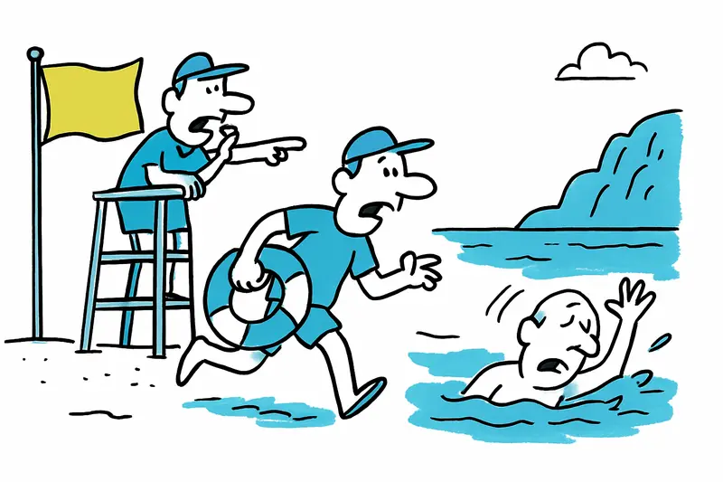
Warning Flag Ignored: Tourist Dies Off Cala Domingos – A Reality Check
An approximately 70-year-old German tourist drowned off Cala Domingos Petit despite warnings from lifeguards. Why do war...
More to explore
Discover more interesting content

Boat Tour with BBQ along Es Trenc Beach

Private transfer from Mallorca Airport (PMI) to Pollensa
