Storm warning in Mallorca: Is the island prepared for wind and rain?
AEMET reports strong easterly winds for Friday, gusts up to 80 km/h and local showers. Why the warning is more than a weather notice — and what municipalities, ports and travelers should do now.
Rapid weather change: AEMET sounds the alarm — and we ask: Are we ready?
Still in a T-shirt on Thursday evening, by Friday gusts tearing at the palms. The Spanish weather service AEMET has issued a severe weather alert for Mallorca: Alerta de tormenta en Mallorca: ¿Está la isla preparada para viento y lluvia?, strong easterly winds, localized gusts around 80 km/h, increased sea state and local showers. For harbor residents, ferry passengers and everyone having their espresso on the Passeig, this is not just a notice but a practical wake-up call.
What wind and rain concretely mean
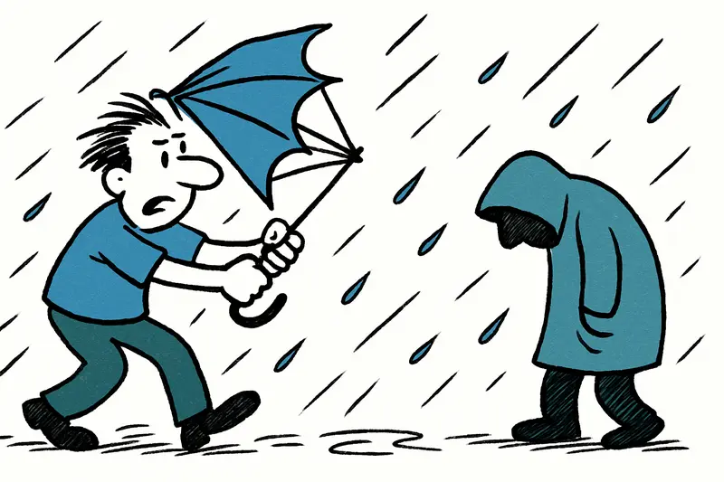
Quite simply: small boats still tied up might sustain damage. In the harbor you then hear the clatter of fenders, the creak of masts, and port authorities will be busy. Ferries can experience delays or cancellations, especially in the morning when the wind may pick up, as noted in Storm alert on Friday: Is Mallorca prepared for heavy rain?. On exposed stretches of coast – the Passeig, Port de Sóller, the breakwater in Port d’Alcúdia – conditions will be unpleasant. Umbrellas are usually useless in gusts; waterproof jackets and sturdy shoes are better.
Key question: How well is Mallorca's infrastructure prepared for such events?
That is the real question behind the warning. A short shower with wind remains an experience; but if such storm events become more frequent or stronger, weak points appear: outdated sewage systems, poorly reinforced waterfronts and inadequately secured boats. In narrow streets like Alcúdia or Inca, heavy rain can quickly produce puddles and small floods. And roadside you often still find loose garden furniture or scaffolding that can become dangerous in gusts.
What is often left out in public discussion
We talk a lot about short-term inconveniences and less about long-term consequences. These include erosion of popular beaches, damage to promenades and the strain on local agriculture: young fruit trees, olive groves and vegetable crops are vulnerable to strong winds and heavy rain. On the other hand, intense, concentrated rainfall can temporarily refill reservoirs – an opportunity in times of scarce water resources that can only be seized with targeted water management, a point discussed in Storm Alert: Is Mallorca Prepared for the Deluge?.
Concrete opportunities and solutions – short-term and long-term
In the short term, port authorities should activate staff for additional checks and encourage boat owners to inspect lines and fenders. Traffic control systems and airports must have flexible plans ready: anyone flying early in the morning or taking a ferry should check connections the evening before and immediately before travel. Municipalities can avoid a lot of alarm by quickly spreading information via SMS, social media and multilingual signs in tourist centers, as explained in Orange Alert in Mallorca: What the AEMET Warning Means for the Island, Roads and Tourism.
In the long term, modernizing sewer systems in historic town centers is worthwhile, as is constructing more robust coastal protection measures in particularly vulnerable sections and investing in intelligent early warning systems. Port operators could organize joint berth inspections, boat insurance companies could offer stronger prevention incentives – and the tourism industry should have emergency plans ready for festivals or boat trips.
Practical tips for residents and visitors for Friday
Secure garden furniture and loose items, check small boats and keep informed via AEMET website and the local port authority. If you go to the coast: do not park right at the water's edge, avoid walking on exposed breakwaters and wear sturdy shoes. If you have a ferry or flight planned: early-morning connections are more vulnerable, evening connections are often more stable – but weather, not the timetable, will decide.
Outlook for the coming days: a weather roller coaster
What is interesting is the rhythm: the low will bring a noticeable drop in temperature – a small harbinger of autumn. But from Sunday models expect temperatures to swing back the other way: inland highs of 35–37 °C, for example near Santa María del Camí or Algaida; Sóller and Pollença could approach 35 °C again. That makes planning harder: short, intense events followed by summer heat.
A personal closing thought
I had an espresso on the Passeig while clouds quickly gathered. The rustling of the palms, the squeak of harbor lines – typical Mallorca sounds on a changeable day. Moments like these are a reminder: we don't need pessimism, but better preparation. A few pragmatic measures today can prevent larger damage tomorrow. So take sunscreen and a sweater – and check your boat lines.
Frequently asked questions
What should I expect in Mallorca during a storm warning?
Is it safe to go to the beach in Mallorca when there is strong wind?
Should I check ferry times in Mallorca before I travel during bad weather?
What should I pack for a windy, rainy day in Mallorca?
How does heavy rain affect Mallorca’s towns and roads?
Is Port de Sóller affected by strong wind in Mallorca?
Can storms in Mallorca damage boats left in the harbour?
Will the weather in Mallorca stay cool after a storm warning?
Similar News

Camper Takes Over Ancient Greek Sandals: Mallorca's Shoemaking Tradition Meets Greek Sandal Craftsmanship
Camper secures a majority stake in Ancient Greek Sandals. For Mallorca this means greater visibility for craft and desig...

Dead dolphin in Caló des Moro: Who takes care — municipality or coastal authority?
A dead dolphin lies on the narrow bay of Caló des Moro near Santanyí. Removal is stalled because only land-based resourc...

Ulises Seeks Peace: A Sensitive Dog Needs a Patient Home
Ulises, a traumatized dog in Mallorca, has made progress at a shelter. He now needs a quiet home with steady care and a ...

Between Punishment and Impunity: Why Six Perpetrators in the Manacor Case Won't Go to Prison
Six men humiliated and severely assaulted a man with an intellectual disability in Manacor. The court imposed short pris...

Vacationers at Ballermann: How the Latest Pickpocket Tricks Work — and What Really Helps
An Instagram video from Playa de Palma shows how groups of thieves exploit older and intoxicated holidaymakers. What’s b...
More to explore
Discover more interesting content

Boat Tour with BBQ along Es Trenc Beach

Private transfer from Mallorca Airport (PMI) to Pollensa
