New Consell map app shows Mallorca from a bird's-eye view since 1968
New Consell map app shows Mallorca from a bird's-eye view since 1968
The Consell de Mallorca has released an interactive map viewer: free aerial images from 1968 to today, mobile-friendly, with comparison and measurement tools — a practical tool for citizens, schools and planners.
Consell unveils aerial image viewer: Mallorca from 1968 to today with a click
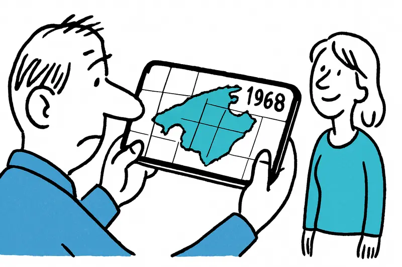
On the Passeig del Born, between the clatter of delivery vans and the scent of freshly baked pan payés, it's easy to imagine: the same streets, the same squares — and yet much has changed. The Consell de Mallorca has now released a tool that makes these changes visible to everyone: a free map viewer that brings together historical and current aerial photographs of the island from 1968 to today.
A tool for everyday use — not just for professionals
The application runs in the browser, requires no login and also works on smartphones, much like the Balearic government's interactive map that displays available nursery places. Users can compare two map years side by side, measure distances and areas, and save views as PDFs. Handy if, for example, you stand at Playa de Palma and want to see how the coastline or development has changed over the past five decades.
I tried it briefly while sipping my coffee on a windless morning in Port de Sóller: a quick look at 1968 shows fields where holiday apartments now stand. Those little aha moments are what make the tool useful — for neighbours who want to know how their area used to look, as well as for teachers looking for illustrative material for school projects.
Practical local uses
Some practical examples: municipalities can document changes in green spaces with the measurement tools, environmental groups can track erosion processes on beaches, architecture firms can measure plots, and amateur historians can research historical land use. Hikers in the Serra de Tramuntana can check how paths ran decades ago — directly in the field, without a thick atlas.
The export function as a PDF is useful when you want to share results with the neighborhood assembly or a club group. That the whole service works on mobile is not a luxury — on Mallorca decisions are often made where you happen to be: on the beach, in the village square or on the Calle de Jaume III.
Why this is good for Mallorca
Such maps create transparency and a shared view of development. For an island that depends on tourism, nature conservation and local identity, this is a valuable addition to public tools and complements historical perspectives such as When Mallorca Began with Propellers. They make visible how agriculture, urban planning and the coastline have interacted. For an island that depends on tourism, nature conservation and local identity, this is a valuable addition to public tools: it's easier to argue when you have data and images right in front of you, alongside recent local initiatives such as 86 interactive screens in 43 Mallorcan municipalities.
Of course the app does not replace in-depth expert reports. But it is a low-threshold offering that makes information accessible — for citizens, small associations, pupils and municipal employees alike.
The next time you walk along the Plaça Major and hear the bells, open the app on your phone, go back a few years and see how the space was used before. It is a new piece of collective memory for the island — practical, educational and surprisingly personal.
Try it out: a small bird's-eye glance can help you understand your part of Mallorca better — and start a conversation about it.
Frequently asked questions
How can I compare old and current aerial photos of Mallorca?
Is the Mallorca aerial map viewer free to use on a phone?
What can I do with the new Mallorca map app besides looking at old photos?
How can I use aerial maps in Mallorca for school projects or local research?
How has Playa de Palma changed over time according to Mallorca’s new map viewer?
Can I use the Mallorca map viewer to look at Port de Sóller or the Tramuntana?
Can the Mallorca aerial map help with coastal erosion and green space studies?
Why is Consell de Mallorca’s new aerial map useful for residents?
Similar News
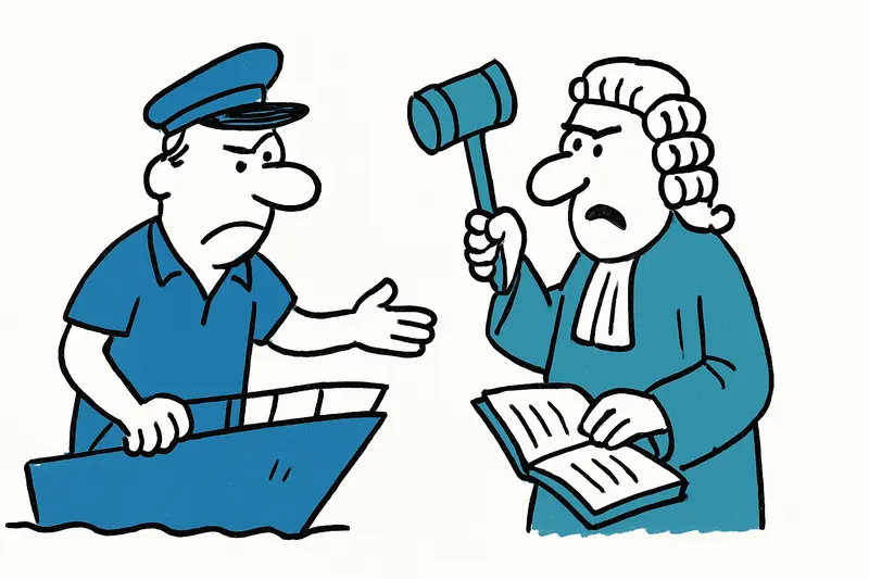
Fatal yacht accident in Cala Bona: Are the requirements for the captain sufficient?
The court maintains monthly reporting obligations and the withdrawal of passport and boat license. One question remains:...

Game, Set, Applause: Glamorous Opening of the Mallorca Championships 2026
A summery opening of the Mallorca Championships 2026 at the Mallorca Country Club: celebrities, live music and a new sta...
Little Brunch at Playa de Palma: Why the Launch Is Slow — A Reality Check
Marco and Tamara Gülpen recently opened "Little Brunch" on the ground floor of their hostal at Playa de Palma. The openi...

"My Favorite Island": Emily Ratajkowski Back on Mallorca
U.S. model Emily Ratajkowski is once again spending time on the island: Cala Deià, a dinner by the sea and a stay in the...
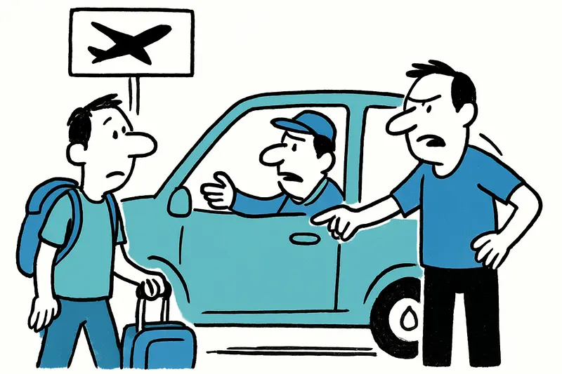
Directly from the airport to Son Banya: When a transfer becomes a trip to the drug village
Shortly after landing, several German holidaymakers were picked up at the airport by a driver and taken to Son Banya — t...
More to explore
Discover more interesting content

Boat Tour with BBQ along Es Trenc Beach

Private transfer from Mallorca Airport (PMI) to Pollensa
