
After the Extreme Storm: Where on Mallorca the Most Rain and Wind Fell — and What's Missing Now
The severe storm left locally large amounts of water and strong gusts. Manacor topped the rainfall list, Cala Rajada topped the wind scale. An assessment — with a critical question about infrastructure and warning systems and concrete proposals.
After the Extreme Storm: Where on Mallorca the Most Rain and Wind Fell — and What's Missing Now
Key question
How well is the island prepared for localized heavy rain events — as discussed in Storm Alert: Is Mallorca Prepared for the Deluge? — and why did some places like Manacor fill up while Calvià received hardly any drops?
Critical analysis
Wednesday brought very different local conditions, as described in Two Mallorcas in One Day: Why Heavy Rain Affects Us More Than We Think: with 69.4 liters per square meter, Manacor was the hardest hit, closely followed by Llucmajor with 65.8 l/m². Son Servera reported 48.4 l/m², Palma Airport 35.9 l/m² and Artà 35.2 l/m²; surprisingly few 0.4 l/m² fell in Calvià. At the same time, measuring stations recorded sometimes strong gusts: Cala Rajada reached 109 km/h, the University of Palma recorded 94 km/h, Cap Blanc 73 km/h and Campos 60 km/h. In Banyalbufar gusts remained moderate at 39 km/h.
What the dry numbers hide
Numbers show quantities and wind, but not where water could not drain: clogged roadside ditches, small bridges choked with debris or narrow channel sections do not appear in measurement data. Differences in soil sealing, terrain profile and local vegetation are also barely reflected — factors that can turn heavy rain into local floods.
A scene from everyday life
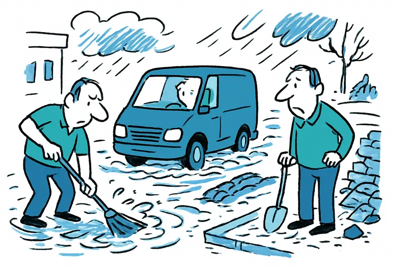
Passeig Mallorca still smells of wet asphalt, a restaurant owner sweeps together terrace chairs, a delivery van carefully makes its way through puddles. In a side street of Manacor residents stand with shovels trying to free a driveway; at the port of El Toro boats lie closer to the quay base, beach chairs are overturned. Such images repeat in different variations across the island — always where sewers and landscape do not work together.
What is missing from the public discourse
People talk about rainfall totals and wind peaks, but rarely about preventive maintenance: when were cross-drains last cleaned? Are there flood-hotspot maps that municipalities, emergency services and tourists can use, as highlighted in After the Thunderstorm: Flooded Streets, Mudslides and the Big Question About Mallorca's Preparedness? The issue of building regulations for new sealing and private rainwater retention also comes up too infrequently. And very practically: many tourists do not know local emergency numbers or safe assembly points.
Concrete solutions
1) Systematic inspection and cleaning of roadside ditches, grates and small bridges before the autumn begins; priority for known hotspots such as parts of Manacor and Llucmajor. 2) Quickly available flood maps: a simple, publicly accessible municipality-level map with markings for risk zones. 3) Temporary retention basins and more permeability in new construction projects — rainwater retention on properties reduces peak loads in the sewer network. 4) Improved communication: clear information in multiple languages at tourist centers, airports and ports, plus an SMS warning system for extreme rainfall and warnings like those in Storm warning in Mallorca: Is the island prepared for wind and rain?. 5) Expansion of local emergency plans in schools, hotels and care homes; regular short drills with fire and civil protection services.
Why this matters
Quick measures cost less than cleanup after floods. Those who now invest in maintenance and information minimize damage and protect people — especially in communities that were hardest hit in this event.
Conclusion
The monitoring stations gave clear signals: localized heavy rain and strong gusts can create completely different conditions within a few kilometers. The island has the data — what is often missing is the link from data to locally implementable measures. We need fewer surprises and more preparation; the next episode can come sooner than we think.
Frequently asked questions
How prepared is Mallorca for localized heavy rain events?
Why did Manacor flood so much while Calvià saw almost no rainfall?
What were the rainfall and wind measurements during the Mallorca storm?
What concrete steps are proposed to reduce flood risk in Mallorca?
How can tourists stay safe and informed during storms in Mallorca?
Would publicly available flood risk maps help Mallorca communities and visitors?
What building or drainage changes could reduce flood peaks on Mallorca?
Why is it important to act now after this storm in Mallorca?
Similar News

Trial in Palma: How safe are intoxicated women in Mallorca's nightlife?
A man is accused of sexually assaulting a heavily intoxicated woman in her Palma apartment in 2022. The prosecution dema...
Deadly Fall in Felanitx: Could the Accident Have Been Prevented?
A 67-year-old woman in Felanitx fell during heavy rain and drowned under a parked car. Why so many risks remain on our s...
Defendant Allegedly Deceived Court with Fake Payment Receipts – Reality Check from Palma
A German real estate entrepreneur must answer in Palma: he is accused of presenting forged payment receipts to erase an ...

'We can't sell a beer for two euros' – Why rents are crushing gastronomy in Mallorca
High concession fees, speculative landlords and tourist hotspots: restaurateurs in Mallorca complain about a development...
Storm on the Radar: Why Palma's Airport and We Are Not Fully Prepared
Orange warnings, strong gusts and initial flight cancellations: anyone flying to or from Palma today should expect delay...
More to explore
Discover more interesting content

Boat Tour with BBQ along Es Trenc Beach

Private transfer from Mallorca Airport (PMI) to Pollensa
