First mild, then storms: Is Mallorca prepared for the new rain front?
First mild, then storms: Is Mallorca prepared for the new rain front?
AEMET warns: After warm days an Atlantic front will bring rain and thunderstorms. We ask: How well are roads, events and services equipped — and what can each of us do?
First mild, then storms: Is Mallorca prepared for the new rain front?
Guiding question: What does the announced phase of rain and thunderstorms mean in concrete terms for everyday life, festivals and roads on the island?
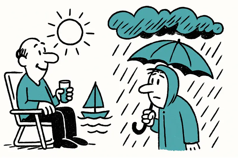
Forecasts from the national weather service point to an abrupt change: a few mild and sunny days, then an Atlantic front bringing rain and isolated thunderstorms, as noted in New Storm Front on Mallorca: How Prepared Are the Island and Its People?. In Palma's cafés on the Passeig del Born people still sit in light jackets, children run around Parc de la Mar, and a few excursion boats lie in the sparkling bay. Such scenes can change within a few hours when the first heavy clouds roll in and the wind shifts to the southwest.
Short-term forecast (over the coming days): Wednesday still promises mild temperatures, with local highs around 20 °C possible. From Thursday more clouds will arrive and highs will fall to around 16–18 °C. On Friday the first showers are possible; from Saturday onward sustained rain and thunderstorms are expected — precipitation may be heavy in places and could continue into the new week, as outlined in Severe Weather Warning for Mallorca: Are Our Towns and Beaches Prepared?.
Critical analysis: where the danger lies
The difference between a normal rain event and a problematic storm hinges on three points: how quickly the precipitation falls, where the water is drained, and how traffic and utility networks respond. In Mallorca narrow streets, older sewer networks and low-lying squares converge. Locations such as the underpasses on Avenida Jaime III, the small stream situations inland and the area along Platja de Palma are more prone to short-term flooding. Tightly parked cars and vegetated manhole covers further slow drainage.
Many municipalities have routines — for example inspection drives by city technicians before heavy rain — but public discussion often misses the question of priorities: Which streets will be cleared first? Where are sandbag or maintenance-sack stocks kept? How will information be distributed to workers, organizers and tourists who do not all use local news channels? This was a central concern during the Storm alert on Friday: Is Mallorca prepared for heavy rain?.
What is missing from the discourse
Public discussion usually focuses on temperatures and rainfall amounts, less often on preventive measures. Too little attention is given to: the capacity of pumping stations in coastal towns, the regular maintenance of street drains in winter and coordination between the island councils and the small town-hall teams. Also rarely discussed are simple tips for businesses: securing outdoor dining in time, keeping tarpaulins ready for open market stalls and equipping events with an official emergency plan.
Scene from everyday life
Friday noon in Portixol: the waves are rising, a fisherman uses a short lull to mend nets. A city service crew is cleaning a drain near Calle Joan Miró; a boy in a rain jacket watches the machines with curiosity. This is what prevention looks like — small, local, sometimes improvised. But it only truly protects if it is comprehensive and planned.
Concrete suggestions — what authorities and residents should do now
For municipalities: 1) Create priority lists for streets (access to hospitals, main traffic routes, school routes). 2) Keep pumps, generators and sandbags at central points. 3) Test phone chains and SMS alert systems so quick notices about closures are possible. 4) Coordinate with water and wastewater utilities: check emergency schedules for pumping stations.
For organizers and businesses: secure terraces and market stalls, plan alternative venues for outdoor concerts, inform employees about detours. For households: check gutters and downpipes, secure loose garden furniture, keep insurance documents handy.
For everyone: actively subscribe to AEMET weather warnings (see Yellow Storm Warning: How Well Is Mallorca Prepared for Heavy Rain?), avoid streams and power line corridors during heavy rain, do not touch electrical appliances if water has entered, and keep animals indoors.
Concise conclusion
The forecast weather is not a catastrophe per se — but it is a test of our local infrastructure and organization. Those who see cleaner processes in place during rain do not have magical powers, but preparation. And those enjoying the mild weather should be aware: the island could look very different by the weekend. A bit of attention and a few pragmatic measures by municipalities and citizens are often enough to turn a wet nightmare into an annoying but manageable episode.
Frequently asked questions
When is the rain front expected to reach Mallorca?
How warm will it be in Mallorca before the storms arrive?
Can you still go to the beach in Mallorca if storms are forecast?
Which parts of Mallorca are more likely to flood during heavy rain?
Is Palma likely to be affected by the storm front?
What should Mallorca residents do before heavy rain and thunderstorms?
How should Mallorca businesses and event organisers prepare for bad weather?
Where can I get official weather warnings for Mallorca?
Similar News

Game, Set, Applause: Glamorous Opening of the Mallorca Championships 2026
A summery opening of the Mallorca Championships 2026 at the Mallorca Country Club: celebrities, live music and a new sta...
Little Brunch at Playa de Palma: Why the Launch Is Slow — A Reality Check
Marco and Tamara Gülpen recently opened "Little Brunch" on the ground floor of their hostal at Playa de Palma. The openi...

"My Favorite Island": Emily Ratajkowski Back on Mallorca
U.S. model Emily Ratajkowski is once again spending time on the island: Cala Deià, a dinner by the sea and a stay in the...

Directly from the airport to Son Banya: When a transfer becomes a trip to the drug village
Shortly after landing, several German holidaymakers were picked up at the airport by a driver and taken to Son Banya — t...

Blockade on the Ma-10: Why a Flat-Tire Bus Paralyzes the Tramuntana
Between Deià and Sóller a coach came to a standstill on the Ma-10 on Thursday midday. A tyre blowout, two buses on the n...
More to explore
Discover more interesting content

Boat Tour with BBQ along Es Trenc Beach

Private transfer from Mallorca Airport (PMI) to Pollensa
