Severe Weather Warning for Mallorca: Are Our Towns and Beaches Prepared?
Heavy rainfall and thunderstorms are approaching: up to 140 l/m² possible. We ask: Are drainage systems, traffic and tourism prepared — and what must be done immediately?
Severe Weather Warning for Mallorca: Are Our Towns and Beaches Prepared?
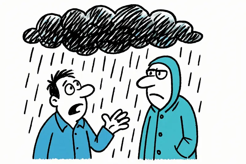
As I walked through Palma in the late afternoon, the sea sounded a little rougher than usual, the air smelled salty and a cold wind played through the plane trees on the Passeig. The central question is clear: Are our streets, beaches and tourist infrastructure really prepared for the forecast heavy rain events? Meteorological services such as AEMET weather warnings page are warning of heavy showers, local flooding and thunderstorms that could strike on the night into Tuesday and on Tuesday itself.
Schedule and Warning Levels
Yellow alerts were already issued for Monday afternoon (see the island-wide yellow warning); the situation is expected to worsen on Tuesday when the alert level is raised to orange nationwide. This escalation is detailed in Aemet warns of up to 140 liters per square meter. The phase with the highest risk is expected from the night into Tuesday until the early morning hours of Wednesday (around 7:00 a.m.). Anyone with plans on Tuesday — a beach walk, a visit to the Santa Catalina market or a drive into the Tramuntana valley — should be cautious and consider alternatives.
How Serious Is the Danger?
Models predict locally up to 140 liters per square meter in a short period. Practically speaking, this means: inner-city areas such as Palma’s quarter around the Plaça Major, low-lying parking bays at Playa de Palma or underpasses on the Paseo Marítimo can fill within minutes. Such rapid flooding has been reported in flooded streets and closed parks. Added to this is the combination of a cool upper-level flow and a still-warm sea (around 27 °C), which provides additional energy to thunderstorm cells.
Underestimated Consequences
Often underestimated is how much such episodes affect agriculture, sewage systems and older residential areas outside the main tourist centers. In rural areas around Llucmajor or Santanyí many fincas lie in lower locations — there live elderly people with limited mobility who rely on quick assistance. The urban drainage system, which reaches its limits during short, extreme precipitation, can also cause pressured sewage to enter basements and streets. And for landlords and restaurateurs: which insurance policies cover the damage? Many damages only become visible once the water has receded. Local coverage, for example the storm alert covering heavy rain, gusts and falling temperatures, highlights these wider impacts.
What Municipalities Should Do Now
Concrete steps that could help immediately: check and clean manhole covers and gutters, prepare mobile barriers at known weak points, inspect emergency shelters in community centers and plan the evacuation of older peripheral areas. In the short term, clear information at tourist information points, hotels and holiday rental hosts is worthwhile so guests are informed about evacuation routes and assembly points. In the medium term the island must invest in better rain retention structures, larger sewer cross-sections and an interconnected early warning system — also to reduce the costs of damage.
Tips for Residents and Visitors
Some practical measures anyone can take immediately: do not park in low parking bays or under trees, secure terrace furniture, avoid riverbeds and dry streambeds during heavier showers, and do not drive through flooded underpasses. Back up important documents and photos, and inform elderly neighbors. If you see unusual amounts of water or damage, report it to the local police or civil protection — better to raise the alarm one time too many than to face a wet surprise.
Outlook
The storm will also bring a drop in temperature: highs are expected to fall by about 5–6 degrees to roughly 24–26 °C. From Wednesday the showers should weaken, and Thursday may bring a calming, although local afternoon thunderstorms cannot be ruled out. For many Mallorcans this means: a restless night, attentive hours and then hopefully a quick cleanup process. Better preparation will catch us less off-guard next time it rains — and perhaps after the storm there will even be room for the sun to peek out again over Palma’s wet cobblestones.
I’ll check the coast again this evening — if the wind smells the way it does now, caution is warranted. Keep your eyes and ears open, and remember: after the rain comes the planning.
Frequently asked questions
Will there be heavy rain and thunderstorms in Mallorca on Tuesday?
Is it safe to go to the beach in Mallorca during a storm warning?
What should I do if I am driving in Mallorca during heavy rain?
What temperature drop can Mallorca expect after the storm?
Is Palma at risk of flooding during heavy rain?
Are rural areas in Mallorca also affected by the storm?
What should residents and holiday rental guests in Mallorca do before the storm?
When will the weather improve in Mallorca after the storm?
Similar News

The 'Kaos' off Camp de Mar: 110-Meter Luxury in Sight
Shortly after noon the 110-meter superyacht "Kaos" glided past Camp de Mar. A look at the machinery, the onboard ameniti...
Alcudia tightens parking rules: 200 tickets, green zones and an agitated summer district
Since the introduction of the so-called green zone, Alcudia has issued 200 fines in the first days. How fair is the meas...

Sun Protection for Your Wallet: How Holidaymakers in Peguera Save on Sunbeds and Umbrellas
Those who don't want to go to the beach with just a towel and a makeshift solution can find affordable alternatives to s...
Car limit in Mallorca: Key questions, risks and concrete proposals
The island council is planning a fee for cars not registered in Mallorca. We ask: How will it work in practice, who will...

When Mallorcan Shoemaking Embraces Athens: Camper Takes Majority Stake in Ancient Greek Sandals
The Fluxà family strengthens Camper's premium segment: with the majority stake in Ancient Greek Sandals the Greek brand ...
More to explore
Discover more interesting content

Boat Tour with BBQ along Es Trenc Beach

Private transfer from Mallorca Airport (PMI) to Pollensa
